Skip to main content Skip to complementary content
Close announcements banner

Configuring the components

Procedure

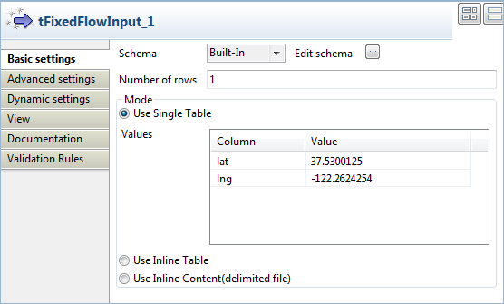
  1. Double-click tFixedFlowInput to display its Basic settings view to define its properties.
  2. Click Edit schema to open a dialog box that displays the data structure of input data and define the data you want to pass to tGoogleMapLookup, two columns in this scenario, lat and lng respectively to hold the geographic coordinates.
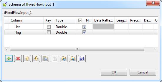
  3. Set the Type of column lat and column lng to Double. Leave rest of the settings as they are. Then, click OK to close the dialog box.
  4. Click Use Single Table in the Mode area, fill the Value field of the lat column with 37.5300125 and that of the lng column with -122.2624254.
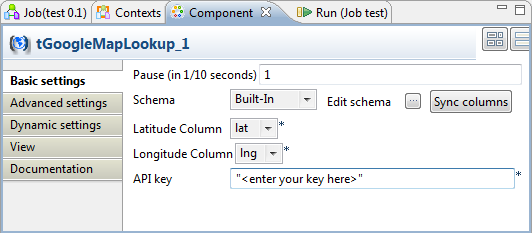
  5. Double-click tGoogleMapLookup to display its Basic settings view and define its properties.
  6. Select the latitude and longitude columns defined in the input schema, lat and lng respectively in this example, and leave the rest of settings as they are.
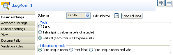
  7. Double-click tLogRow to display its Basic settings view and define its properties.
  8. Select Vertical (each row is a key/value list) in the Mode area and Print unique name in the Title printing mode area.

Did this page help you?

If you find any issues with this page or its content – a typo, a missing step, or a technical error – let us know how we can improve!